
A compass needle pointing north can seem as inevitable as sunrise and sunset. Yet the magnetic North Pole does not remain obediently fixed in one place: it has been moving for years, and has now shifted significantly again. Specialists have therefore had to revise key navigation reference models earlier than expected. This affects not only the military and airlines, but also a wide range of everyday applications.
Why the magnetic North Pole is always on the move
The magnetic North Pole is not a pin fixed in the Earth’s mantle, but more like a moving hotspot within the planet’s global magnetic field. Its behaviour is driven by the Earth’s core: at a depth of around 3,000 kilometres, liquid electrically conductive metal, chiefly iron, flows around. These movements create electric currents, which in turn generate the magnetic field.
As those flows continuously change, the field’s overall pattern shifts too. It is rather like a pan of boiling water, where eddies form in one place and then another. The magnetic field responds to these changes, although at a much slower pace.
Since it was first measured precisely in the 19th century, the magnetic North Pole has travelled more than 2,000 kilometres, moving from northern Canada towards Siberia.
For a time, the pole was travelling at more than 70 kilometres per year. Current assessments show that its pace has slowed markedly, to around 35 kilometres annually. Experts describe this as the sharpest slowdown recorded so far.
An invisible shift with tangible consequences
When using nothing more than a basic walking map and compass in upland terrain, a deviation of a few degrees is unlikely to matter much. But even small discrepancies are significant for precise air and maritime navigation, military operations, surveying work, and modern car and smartphone electronics.
How authorities map the Earth’s magnetic field
To turn the chaotic magnetic field into a dependable guidance system, experts rely on two principal models:
- International Geomagnetic Reference Field (IGRF): A mathematical model calculated from satellite data and ground-based measurements. It represents the large-scale structure of the field.
- World Magnetic Model (WMM): The practical version used by navigation and positioning systems. It serves as the reference for thousands of navigation computers.
The WMM is produced jointly by the US oceanic and atmospheric research agency and the British Geological Survey. Under normal circumstances, it is updated every five years. The present edition was originally intended to remain valid until 2030. However, the unexpected slowing of the North Pole’s movement has meant the calculations needed to be corrected ahead of schedule.
When the magnetic pole moves differently from what was forecast, the entire coordinate system on which modern navigation depends shifts.
When a runway suddenly has the “wrong” number
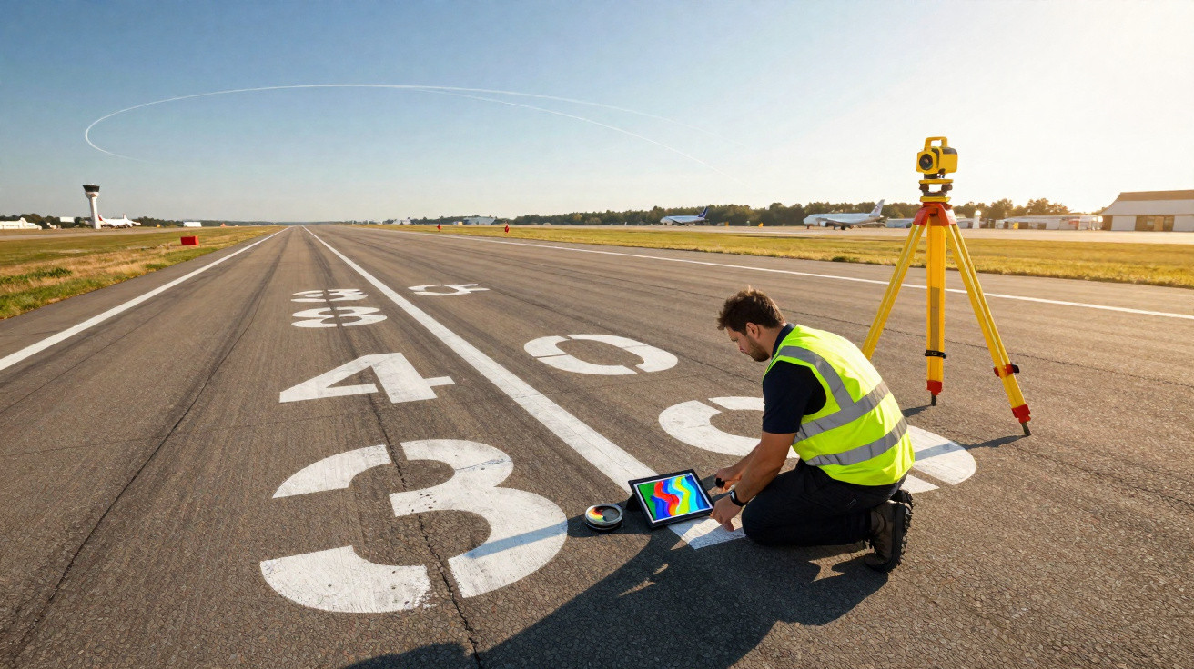
Few people realise that airport runway numbers are based on magnetic north. A runway marked “09” is aligned at roughly 90 degrees, meaning eastwards. If magnetic north moves far enough for the difference to become too great, the numbers no longer match.
Airports must then survey their runways again, update charts, replace signs and inform pilots. This does not happen every week, but the current change to the magnetic model is requiring a number of airports worldwide to make such adjustments, sometimes including software updates to cockpit systems.
Ships, drones and cars: who depends on the magnetic field
The updated data affects far more than aviation. Among those using the WMM are:
- Merchant and naval vessels whose navigation computers account for magnetic north
- Military systems and alliances such as NATO
- Surveying services, geologists and engineering firms
- Manufacturers of smartphones and tablets fitted with digital compasses
- Vehicle makers using navigation and driver-assistance systems
- Drones that rely on compass data
Most users will notice the transition only indirectly, perhaps when their sat nav requires a firmware update or an app asks for the compass to be updated.
A new model with far sharper resolution
As part of the revision, specialists have done more than simply adjust the figures: they have also refined the model. Previously, the field could only be represented in relatively broad detail, with a typical accuracy of around 3,300 kilometres at the equator. That level is sufficient for large-scale navigation, but is too imprecise in complex areas such as coastal regions or densely populated areas.
The new high-resolution version of the magnetic model improves accuracy at the equator to about 300 kilometres – a gain of roughly an order of magnitude.
This makes it possible to calculate courses more reliably in difficult environments, including narrow shipping channels and regions near the poles. Navigation systems can also distinguish magnetic effects more effectively from other sources of error.
What this means in everyday life
Most people will see little direct evidence of these developments. Nevertheless, the new data will gradually be incorporated into everyday devices. Typical effects include:
- Smartphones can determine directions more accurately in map apps, particularly near borders and at high latitudes.
- Car navigation in northern regions can calculate routes slightly more precisely, for example on journeys through fjords or island groups.
- Drones benefit from more stable compass readings, smoothing flight paths and making crashes caused by navigation errors less likely.
The difference may appear minor to non-specialists, but collectively it improves the reliability of many digital services.
How the movement of the magnetic pole is measured
The models are based primarily on satellites that measure the Earth’s magnetic field at different altitudes. They record minute changes in the field’s strength and direction. These readings are supplemented by ground stations, ocean measurements and data gathered by research vessels.
Millions of measurement points are used to create complex mathematical models. They describe:
| Layer | What is measured | What it is used for |
|---|---|---|
| Earth’s core | Slow changes in the main field | Forecasting pole movement, long timescales |
| Earth’s mantle and crust | Local anomalies caused by rocks | Resource exploration, geological maps |
| Ionosphere and magnetosphere | Short-term fluctuations caused by solar activity | Space weather, protection of sensitive technology |
Combining these layers makes it possible both to model the magnetic field’s long-term behaviour and to assess short-term disturbances, such as those caused by solar storms.
Risks, misconceptions and a look ahead
Speculation repeatedly appears on social media: could the current slowdown be a sign of a pole reversal? In the Earth’s history, the north and south poles have indeed swapped places several times. Geologists find evidence of such reversals in rock, most recently around 780,000 years ago.
The change now being observed is considerably smaller, however. It shows only that the system is dynamic. A genuine reversal would develop over many thousands of years, not over a few decades. Alarmist claims that the magnetic field is about to collapse therefore belong more in the realm of science fiction.
The situation nevertheless remains sensitive for technology: a weaker or more compressed field allows more high-energy particles from space to approach the Earth. This can damage satellites, disrupt radio communications or place strain on power grids. That is why space agencies and grid operators monitor the models very closely.
People interested in outdoor activities can even draw practical benefit from the dynamics of the magnetic field. Anyone using a traditional compass at high latitudes should regularly check how much magnetic north differs from geographic north. Many topographic maps provide a current correction value for this. In some parts of Scandinavia or Canada, the difference can exceed ten degrees – enough to leave someone substantially off course after only a few kilometres.
At the same time, the refined magnetic model creates opportunities for new applications, from more accurate surveying drones and autonomous ships to assistance systems that can retain useful orientation even without GPS reception. The quiet movement of the magnetic pole forces developers to keep adapting their algorithms – ultimately making technology a little more robust.






Comments
No comments yet. Be the first to comment!
Leave a Comment