
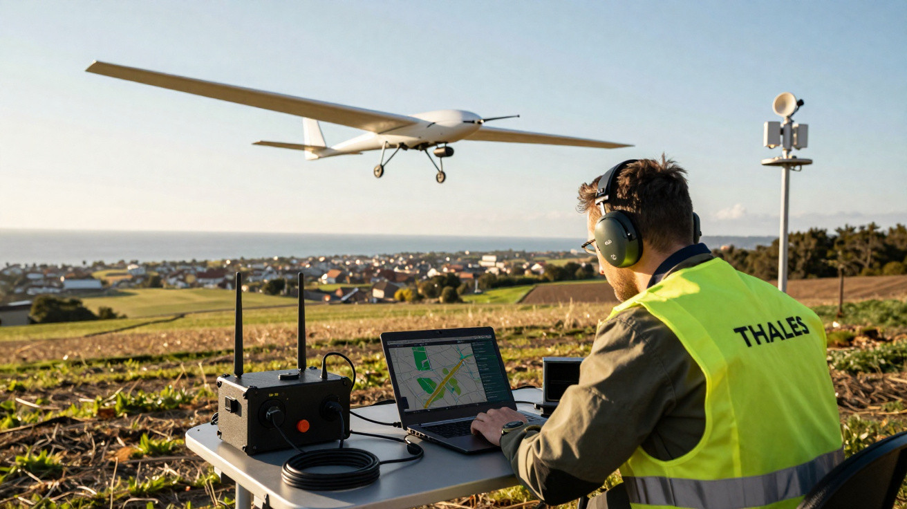
Thales, the French industrial heavyweight, is positioning its UAS100 as a dependable working platform rather than a showy gadget. It is intended for long, routine yet vital missions that helicopters, satellites and short-range drones all handle inefficiently.
From difficult patrols to persistent aerial surveillance
Coastlines, borders and pipelines have always been challenging for planners. They can extend for hundreds of kilometres, frequently across isolated and inaccessible terrain. Ground patrols take time and require significant manpower. Helicopters are quick, but costly to run and loud. Satellites provide only intermittent overpasses, meaning brief incidents may go undetected.
Long-range drones, or BVLOS systems (beyond visual line of sight), are intended to fill this gap. Rather than replacing existing tools, they provide an additional layer: ongoing, comparatively affordable aerial surveillance that can be repeatedly launched from limited ground infrastructure.
Thales’s UAS100 has been designed as an “unstoppable scout”: not spectacular, but built to fly far, stay up long and keep feeding usable data.
These aircraft are very different from the buzzing quadcopters used above construction sites or to record sporting events. Long-range platforms sacrifice manoeuvrability in favour of endurance. They generally feature fixed wings, faster cruising speeds and more efficient propulsion, all designed around distance, consistency and repeatable flight paths.
What long-range drones are actually used for
The UAS100 is clearly targeted at missions where consistent, structured information is more valuable than cinematic images. Its intended applications include:
- Coastal and maritime surveillance
- Border monitoring and law enforcement support
- Inspection of pipelines, railways and power lines
- Large-scale mapping and environmental monitoring
- Search and rescue over wide areas
For these uses, endurance and area coverage soon become more important than maximum camera resolution. A drone able to travel hundreds of kilometres during one mission can assess the same location day after day, spot subtle indicators - a gradual leak, an advancing erosion line or recurring attempts at illegal border crossings - and issue focused alerts to human teams.
Instead of a one-off snapshot, operators get a continuous “film” of what is changing along a coastline, a border or a critical corridor.
The autonomy challenge: more than just battery life
Who is really flying - machine or operator?
For engineers, autonomy in BVLOS drones concerns far more than available energy. It is chiefly about the extent to which an aircraft can operate without continual human involvement. After a drone has passed beyond the horizon, the operator changes from a “pilot” into a “supervisor”.
European regulators, with EASA (the European Union Aviation Safety Agency) at the forefront, insist that this transition is tightly managed. Every automated action must be foreseeable and traceable. Should anything fail, investigators must be able to establish exactly what decision the system made and the reason for it.
The UAS100 uses avionics developed from the certified aviation industry. This includes redundant system architectures, strict software-development procedures and navigation equipment intended to withstand interference or temporary satellite-signal loss.
Handling radio blackouts and crowded airspace
For every long-range drone, losing communications is among the most difficult situations. Radio connections may be jammed, obstructed by the landscape or weakened by weather conditions. A BVLOS aircraft cannot simply remain stationary and wait.
To achieve certification, platforms including UAS100 have to demonstrate that they can carry out agreed fallback actions: ascending or descending to safe heights, steering clear of designated exclusion zones, and returning to base or landing at an alternative location without making improvised decisions.
Regulators want algorithms that behave like disciplined pilots, not creative copilots.
This requires carefully calibrated flight-management systems, resilient navigation and comprehensive simulation before approval is granted by regulators. Drawing on decades of civil and military avionics experience, Thales is wagering that this background will give it an advantage.
A European regulatory framework that raises the bar
The era in which drones could operate in a legal grey area is disappearing. Since 2019, the EU has introduced a formal framework covering system certification, operational permissions, pilot training, maintenance and risk management.
Risk is evaluated through a process called SORA (specific operations risk assessment). It considers ground risks - including the consequences of a drone crash - alongside air risks, such as potential conflict with other aircraft. The resulting assessment determines the necessary safety standard and mitigation measures.
Longer flights near sensitive areas mean higher risk categories, which in turn demand aircraft designed almost like small airliners rather than hobby machines.
For industrial companies, this alters the commercial calculation. Success relies less on producing a nimble prototype and more on supplying a mature “system of systems”: the drone, ground station, protected communications, training, documentation and support.
The UAS100 as a complete system, not just an airframe
Technical profile of Thales’s long-range platform
Thales describes the UAS100 as a family of fixed-wing drones with hybrid propulsion. Early 3.3-metre-wingspan units are already undergoing flight tests, while a larger 6.7-metre model is being readied for its first flights. Full accreditation is planned for the end of 2025.
| Feature | UAS100 characteristics |
|---|---|
| Configuration | Fixed wing, hybrid propulsion |
| Wingspan | 3.3 m (flight tests) / 6.7 m (larger variant in preparation) |
| Operational range | Roughly 200–600 km of linear coverage depending on version |
| Ground crew | Single supervisor controlling a highly automated system |
| Navigation | Designed to resist jamming and operate in complex electromagnetic environments |
| Data handling | Secure private cloud storage with integrity and confidentiality controls |
| Target missions | Coastal and border surveillance, law enforcement support, linear infrastructure inspection |
| Regulatory status | Flight tests ongoing, certification aimed for late 2025 |
The accompanying ground station is designed to lower the human workload. Before flight, processes including weather assessment, obstacle-database checks and restricted-area updates are carried out automatically. In the air, the drone flies pre-programmed routes, while retaining the ability to adjust within defined safety limits.
Concrete use cases on the ground
Thales is not presenting UAS100 as an air-show attraction. Its sales case is aimed at police services, coastguards, infrastructure operators and civil protection bodies.
During a coastal mission, the drone could cover hundreds of kilometres of shoreline, using optical and infrared sensors to identify small vessels, pollution slicks or people requiring rescue. For a pipeline operator, one sortie might inspect lengthy sections of remote ground, find leaks at an early stage and detect encroachment from building work or illegal tapping.
Compared with helicopters, the UAS100 trades speed of response for persistence and cost control; compared with satellites, it offers flexible timing and higher-resolution, task-focused coverage.
A market shifting from start-ups to industrial heavyweights
The worldwide market for drone inspection and monitoring is projected to rise from around $15.2 billion in 2025 to approximately $61.5 billion by 2035. Long-range systems will not account for all of this expansion, but BVLOS platforms are expected to take a growing share where long distances and regulatory requirements coincide.
Europe’s updated regulatory setting benefits companies able to finance lengthy certification programmes and provide support throughout an asset’s life. This is likely to pressure smaller start-ups while favouring larger groups such as Thales, Portugal’s Tekever and Austria’s Schiebel, all of which already serve defence and security markets.
Rivalry is still strong. Rotary-wing VTOL drones, including the Schiebel Camcopter S‑100, are able to operate from ship decks and very small landing areas. Lighter fixed-wing systems from companies such as Quantum Systems and Delair place mapping ahead of exceptional range. Thales is betting that aviation-grade architecture and close integration with established air-traffic systems will appeal to cautious public agencies.
Key concepts and what they mean for users
BVLOS, SORA and hybrid propulsion in plain language
Beyond visual line of sight (BVLOS) means simply that the pilot can no longer see the drone directly, instead depending on instruments and data links. This activates much tougher rules because conventional “see and avoid” procedures are no longer possible.
SORA, Europe’s risk-assessment method, works rather like a detailed checklist for regulators and operators. It examines where the drone will operate, who or what is below it, which crewed aircraft use that airspace and the consequences if the system fails. Every response either increases or reduces the requirements.
In the UAS100, hybrid propulsion refers to combining multiple power sources - for example, an internal-combustion engine with electric components - to balance endurance, redundancy and acoustic footprint. It gives designers additional ways to control fuel consumption, reliability and emissions.
What a typical UAS100 operation could look like
Consider a major energy company in southern Europe experiencing repeated leaks and theft attempts along an isolated pipeline. Rather than sending vehicle patrols every day over difficult tracks, it commissions a UAS100 service.
Every morning, a small team at a regional hub uses the ground station to review weather conditions and restricted zones. The drone departs from a short runway, rises to a safe cruising altitude and follows the pipeline for several hours, transmitting video and sensor information in real time. Algorithms identify unusual heat patterns or suspicious activity on the ground, while operators see only the alerts requiring attention.
The drone becomes part of the routine infrastructure, almost like an automated sensor line in the sky, with humans stepping in only when something looks wrong.
Comparable use cases are being examined for wildfire detection, winter flood surveillance and cross-border smuggling routes. In every instance, its value lies less in dramatic video than in providing a persistent, rules-compliant aerial presence that integrates cleanly with existing airspace and legal frameworks.




Comments
No comments yet. Be the first to comment!
Leave a Comment